Friday, November 18, 2016

Apres Trek Continued - Pokhara and Further East

Still in trek recovery mode, but Pokhara is providing the restorative therapy.


Yesterday, a few quick visits to the bakeries helped.  Wandering around in sandals and shorts helped as well.  As did some good Indian food overlooking Fewa Lake and the hills beyond.  Venus in the western evening sky, Mars somewhat above.


This morning, I walked down to the main street near the Hotel Yeti, remembering seeing a young fellow with a tray of baked goods.  I had only to wait a few minutes and he appeared.  Fifty rupees for a warm chocolate croissant was a good start to the day.

We have some morning fog here on the shores of Fewa Lake.  A few hours earlier we also had the neighbourhood's canine chorus in full voice and shortly thereafter an idiot with one of the few noisy motorcycles I've heard in Nepal.  Yes, 5 am, racing his engine, clearing the pipes, blatting his anti social twitwittery all over the neighbourhood.

Monday we hiked to a set of falls just downstream from Fewa Lake's exit, as well as a nearby cave.


Tuesday, we took the bus to KTM.  About 8 hours for a 200 km trip, including two washroom breaks and 45 minutes for lunch.  Any trip like that will get one thinking about the condition of the roads, traffic issues and infrastructure deficiencies.


There are many, many buses, and there is no place for them to pull over when they stop.  This blocks one whole lane of a major highway, although distinguishing it as such is a bit of a stretch.

The last part of the trip, about 20 km, took almost 2 hours.  Once you crest the ring of steep hills that ring the KTM Valley you quickly drop down into the chaos of Kathmandu.  The first little while, the road seems to be under construction.  That's only an assumption based on the road condition.  I saw no other signs, like workers, construction equipment, etc.  Two lanes, bumper to bumper, bikes, people.  Then it got worse.


The road conditions improved, but now all lanes were packed with buses, trucks, bikes, people crossing.  It was slow going.  And then, for some unknown reason, the bus drops everyone off by the side of the street a couple of blocks from the bus station.

Anyhow, we're back in our home away from home here in KTM.  We're sorting and getting ready for a 3 day bike trip in the KTM Valley.


Wednesday, November 16, 2016

Reflections on Trekking in Nepal's Mustang Region


Over two different trips, I've hiked for a total of about 6 weeks in Nepal.

In 2013, a group of 10 of us hiked for 3 weeks around the Manaslu range and most of the Annapurna range.

Three years later, two of us hiked into the Annapurna sanctuary as far as Annapurna Base Camp.  We then followed that trip with another into the Mustang region of the country.  The latter involved about 160 km of hiking through some very challenging terrain, most of it above 3000 m.


For years, the Nepali government kept the Mustang region closed to foreigners.  This may have had something to do with the political situation in Tibet.  In any case, starting in the mid-1990s, foreign trekkers were allowed in, with restrictions.

First, the number of trekkers each year is limited.  Nothing like the crowds you can see on some other routes.


Second, trekking permit fees are substantially higher than on other routes.  In 2016, for example, a permit cost US$ 50 per person per day.

Third, all trekkers must be guided.  This isn't really a big expense, after all, this in Nepal.  Our guide costs about $25/day and a porter costs about $10/day.  

The scenery is fantastic.  Very stark, very dry, quite windy most afternoons.  Places with lodges are generally small and pretty rough.  It's cold when the sun isn't above the mountains.  Views are compelling in all directions.  The food is basic and there isn't any warm place to go other than in your sleeping bag.

I'd recommend the region for the scenery.  Also for the physical challenge.  There is a great deal of up and down, often on rough tracks.  Not sure if I'd recommend the area for any other reasons.  We've decided that most of the "villages" look better from a distance than they do up close.  Once you've done your hiking for the day and had your meals, there is little reason to wander around and the cold will often force you into your bed.


Sunday, November 13, 2016

Nepal - Apres Trek


So, after spending almost 3 days in Jomsom, we left, happily, at 7 am on Sunday, for a 20 minute flight to Pokhara.


Jomsom is really in quite a nice setting.  Straddling the Kali Gandaki, almost below Nilgiri and within sight of Dhaulagiri, it seems like it should be a great place.  But like many of the villages we visited, it looks better from a distance, and there are a couple of nearby villages that are much nicer and much less noisy, such as Thinigaon and Marpha.


For part of one day, we hiked to the nearby village of Marpha.  Lots of farming in Marpha and a scenic little village as well.


The big problem with Jomsom becomes abundantly clear sometime after 11 am.  Light valley breezes become a howling gale, complete with clouds of blowing dust.  The only sane thing to do is hide inside.

That strategy, however, presents it's own problems, chief being how cold it is inside most buildings.  The solution is to crawl inside your sleeping bag.  And that is how we spent 3 afternoons.  It's enough to drive you to drink, but my drink of choice is beer and feeling frozen is not conducive to beer drinking, at least for me.

Our last day in Jomsom was half nice.  We walked across the river and hiked to Thinigaon, then on to Dhumpa Lake and a monastery overlooking the town of Jomsom, Marpha and area.  The morning flights between Jomsom and Pokhara went right by us.  The picture attached shows Thinigaon, by the way, not Jomsom, which is mostly out of sight to the left.


However, enough time is enough time, and a 20 minute flight later, by 7:30 am the next morning, we were in Pokhara, where it was warm, flowers were blooming, plants were green, no wind was blowing and we were 2000 m lower.

We discovered almost immediately one of the less pleasant facts of Nepali politics.  One of the disgruntled political parties (Maoist, perhaps?), had called a general strike.  No taxis, no buses and many shops closed.  Nobody seemed to know why, though.  Just a number of cars sporting banners and flags and carrying  self-important functionaries up and down the main street.  These were the same nitwits who foiled our attempt to go trekking in the Annapurnas three years ago with a multi-day strike.

Anyway, our guide got a fellow with a car to drive us to our hotel.  Once breakfasted and established in our room, with the laundry done, it was time to get down to business: shopping, finding bakery goods, enjoying the warm temperatures by wearing shorts (first time in 2 weeks) and sandals.

Happy "hour" at a nearby restaurant starts at 4 pm, after which there is a good Indian restaurant not too far away.  And then sleep, when I won't need to sleep in my socks and fleece sweater for the first time in 2 weeks.

Tomorrow we may hike to a set of falls on the river that drains Fewa Lake.  Some shopping in the afternoon and then we leave for KTM Tuesday morning.  A 200 km bus ride that will take 8 hours.


Tuesday, November 08, 2016

The Last Forbidden Kingdom - Trekking in Nepal's Mustang Region - 3


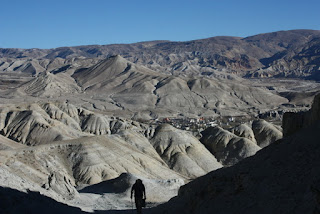
After 4 hours of walking, most of it at elevations approaching or over 4000 m, we drop down to Lo Manthang.


This is, apparently, a UNESCO World Heritage site.  It's definitely old and it has heritage, but in my mind, the best part is the scenery along the trail.


It may be a consequence of being late in the season, but we have found the villages along the way, including Lo Manthang, to have little to recommend them, other than a few pictures.  I'm not finding cattle and their byproducts in all their streets all that endearing.  In some ways, these villages have all the attractiveness of a small prairie town on a hot, dry, summer afternoon. To top it off, it's really too cool to make wandering around all that enticing. The activity that we experienced in KTM and Pokhara is missing here completely.
We have been rethinking our schedule.  There is some hiking we can do a bit further north which we will probably do tomorrow.  We might spend another full day here, just wandering around.  After that, however, we plan to head down valley pretty quickly.

Sunday, Nov 6th

After a very fragmented night of only some sleep, Sunday morning finally arrives.  This lodge was certainly party central last night.  A large group of young Nepalis arrived late in the afternoon, and brought their boom box and associated loud noise with them.  Our room also appears to be right underneath the room with the TV.  Football, anyone?  As well, the social conventions we have at home about smoking inside don't seem to exist here.
They did shut things down early enough.  The music stopped at 9 pm and lights were out at 10 pm or so, but when you go to sleep at 7 pm and are awakened two hours later, it does affect your sleep patterns.

I've also started to notice something odd about my breathing during the hours I've been lying here.  My breathing will be quite shallow, then I get this odd sensation, almost like a mild panic, which causes me to take a couple of deep breaths, after which everything returns to normal.  I think this is a blood chemistry issue caused by the altitude.  I don't notice it when I'm up and walking around because I'm breathing more deeply, but I think it's also affecting my sleep.

Needless to say, I'm not feeling all that perky this morning.

We hike in the morning an hour or so north for the views.  It's windy and cold now so I'm in my sleeping bag again.  Tomorrow we will start heading back to Jomsom.


Monday, Nov 7th

Had a pretty good night.  It was quiet, thankfully, and other than a few hours of podcast listening, the night passed uneventfully.

By 7:30 am, we start hiking south.  We're actually on the trail home.  From now for the next 2 weeks, every km will be either south or east.  In a way, it's the turnaround point in the trip, even though the half way point was reached some time ago.

We hike, mostly on a dirt road, for 5 hours, with a short break for tea in Chrang.  We press on and arrive in Ghami at 1 pm.  After lunch and some laundry, we discover actual HOT showers.


Tuesday, Nov 8th


A long, hard day.  Much up and down, perhaps 25 to 30 km, but the effort got us to Chhuksang, which is back on the Kali Gandaki, within 4 hours of Jomsom.  The hard bit is done now.  Tomorrow we have a leisurely hike to Kagbeni where we can shower and get caught up on news and email.  The next day, we hike a couple of hours to Jomsom.  We'll do some day hikes around Jomsom and fly back to Pokhara on Sunday. 


Saturday, November 05, 2016

Biking in the Kathmandu Valley


Much earlier, we had been offered the opportunity to go biking in the KTM valley before we headed home.  This seemed like a good chance to see more of Nepal.

Day 1

Accordingly, we met our guide at 8 am, walked up the street to the bike rental store, selected our steeds, strapped on our helmets and were ready to go.

Our guide was a young looking fellow who claimed to be 30 years old.  Having agreed that we were ready, there was only one choice when he took off, heading out of Thamel.  Bat out of Hell would be only a slight exaggeration, but in the beginning, we knew where he was going, having walked some of those streets on our own.  The best option seemed to involve sticking right to his tail.

Early in the morning, traffic outside Thamel was admittedly better than at 3:30 pm the previous day, but there was still a steady stream of cars, motorcycles and crossing pedestrians.  And we were driving on the left.  Intersections appeared almost immediately.  Traffic lights don't work in KTM, leaving everyone to figure it out for themselves. The strategy was to pick a hole and go for it.


Following the guide, who to his credit, did glance around occasionally to see if we were still with him, we were quickly on streets unknown to us with road signs that were meaningless, just a very small part of a great flow of motorbikes, buses belching black diesel exhaust, cars, pedestrians crossing, buses stopping, pulling out, everyone changing lanes in random fashion, all honking and beeping around us.

Sometimes the flow slowed, so we moved between lanes, around cars, passing buses, avoiding the occasional motorbike that, for some reason, appeared on our side of the road, coming toward us.  Avoiding the occasional hole where the manhole cover had disappeared.  With one hand, I managed to pull my buff up over my nose in the hope it would filter out some of the dust and fumes.

On some of the road, to my surprise, there was what appeared to be a bike lane.  Aside from stopped buses and the occasional motorbike,  it was mostly ours.


Eventually, we arrived at Bhaktapur, where we left the main highway and began following country lanes.  We climbed to Changu Narayan where we stopped for a hot lemon drink and to visit a temple.  Turns out it is a UNESCO World Heritage site.  Climbing continued, interspersed with some down, until we reached Nagarkot, perched on the outer rim of the KTM Valley, facing the mighty Himalayan range.  The smog of the valley was left behind, a smudge that pretty much obliterated any views to the south.

Our hotel was a newly renovated facility, with a concierge at the entrance, an excellent Indian buffet for lunch and hot showers.  We met all three, in that order.  Our room looked out to those mountains and to the villages and crop terraces laid out below us.


By 4:30 pm, after having had a short nap, we could see the afternoon shadows extending over the valley below and the sun's light glowing on the peaks to the north.  Awhile later sitting on our balcony watching the lights in the valley below and the moon rising over the Himalayas, bats swoop by chasing their dinner

Our guide tells us that tomorrow will be mostly downhill.  This is Nepal.  I am skeptical.

Day 2

Watching sunrise over the Himalayan Range was nice this morning.

Sunrise over the Himalaya
Our days route took us on some rough roads and "trails" as we dropped in elevation down to the level of the main east west highway.  We rode along that for maybe 20 minutes, along with all the trucks and buses until we reached Dhulikhel.  That was our destination for the day.  About 3.5 hours of riding.


I was very surprised to discover that the bike seats had not become more comfortable overnight.  I had left specific instructions.....

Views were good, the trail was rough and my butt is definitely ready for a rest.  It needs some extra padding too, but that's not gonna happen....

The hotel we're in has a great panoramic view of the peaks, arguably as good as Nagarkot.  It also has an excellent rooftop patio from which to survey the view. 

Day 3

Sunrise wasn't as spectacular as yesterday, but I wasn't complaining.

We rode the usual Nepali flat.  Some up.  Some down.  First stop was Namo Bhudda where there was one of the best kept monasteries I've seen on this trip.  After a brief look, we headed down and more down on a dirt track towards Panauti.  Lots of terraces, crops being harvested.

Monsatery at Namo Bhudda
The road from Panauti out to that main highway at Banepa started out so well.  Smooth pavement, of all things.  The guide had been talking to locals and they were telling him the road ahead was under construction.  We found it.  Technically, I don't think it was actually under construction.  There was no evidence of any construction at all.  Just a road torn up, muddy, dusty and rocky.


Back on the main road, we joined the melee of trucks, buses, cars, motorbikes, pedestrians and dogs, weaving to avoid stopped buses, crossing pedestrians and potholes.

We stopped for about an hour at Bhaktapur, just east of KTM.  It too has an old temple square which is listed by UNESCO as a World Heritage site.  Some structures had sustained damage during the 2015 earthquake.

Bhaktapur
We rode on and the highway melee became worse, culminating in total gridlock once in Kathmandu itself.  Throughout, it was pretty much a matter of riding wherever you wanted.  One side, the other side, the middle.  It seemed not to matter.  Up on the sidewalk, squeezing between lanes of traffic.  It was an experience and completely nuts.
I do have pictures but sadly no video.  It was almost indescribable.


We turned in our bikes, said goodbye to our guide and walked back to our hotel, just a little bit shell shocked by the 130 km experience.  Also with a sense of relief.  All the "trips" are over.  We have exactly 4 days left here and all we need to do is walk.  Find some good food.  Shop.  Rest my sore butt.  Whoever designed those bike seats should be flogged at dawn.  Just sayin'.


Pokhara to Kathmandu by Land

Although it is easiest to fly between these two cities, we had decided to take the bus.  It's less expensive but in particular it gives you some exposure to rural Nepal.

I can report that the trip took all of 9.5 hours.  That included two toilet breaks of 20 and 10 minutes each, a lunch break of 1 hour and an unscheduled wait of another 1 hr 46 minutes waiting for a connecting bus to reach us from Chitwan.  This latter "situation" was exactly the kind of thing I was somewhat worried about.  Recall that the Maoist-led transportation strike, or bandh, was still on.  Apparently, angry that the bandh was being broken, a crowd attacked a bus and burned it.  This blocked the road and delayed the connecting bus that we were waiting for.

The road between these two cities is pretty bad.  To start with, Nepal's terrain dictates a narrow, winding track to begin with.  The state of the paving ranges from mildly poor to shockingly awful, considering this is the main highway between the two largest cities in Nepal.  There were few places where the bus could travel faster than 50 km/hr.  Often it was slower much slower.  So even though we only had 200 km to travel, progress was slow.

Add to that a mix of cattle, goats and other livestock occasionally blocking the way.  People also live along the highway, often literally on it.  There were people walking, alone or in groups, biking, playing ...carrying crops, fixing vehicles...  The bus had to navigate all this on a pavement barely 2 narrow lanes wide, with generous use of its uniquely Asian horn.

Finally we crested the hill bordering the Kathmandu Valley, past a final police checkpoint and into the chaos of Kathmandu itself.  Earlier problems now became much worse.  More pedestrians, more motorbikes, buses and trucks.  If you haven't seen a chaotic 3rd world city, it is difficult to imagine how bad it really is.

The bus finally delivered us to the "station" and, slightly disoriented, it only took a couple of false starts before we headed in the right direction, into the inner chaos that is Thamel.  Once landmarks were found, our hotel was quickly located and the trip was finally over.  Our hotelier recognized us from our earlier visit and we were placed in the same room we had occupied nearly 4 weeks previously.  Good pizza and a beer completed the day.

The Last Forbidden Kingdom - Trekking in Nepal's Mustang Region - 2


Kali Gandaki Valley near Kagbeni


Wednesday, November 2nd, 2016

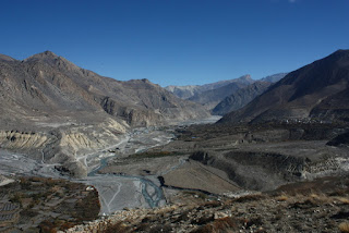
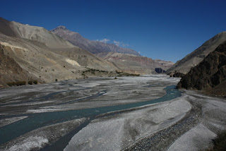
We hike from Kagbeni upstream along the Kali Gandaki.  The river valley itself is quite picturesque.  It reminds me of a mix that might include southern Utah, the desert of Arizona, a touch of the Grand Canyon and some of the Drumheller badlands.


There is a road of sorts.  Quite a bit is like walking on a cobble beach.  Rough and hard going at times.   We see two or three 4x4 land cruiser type vehicles.  Otherwise, it's very quiet.  We have no wind yet.  That doesn't come until after lunch most days.

We pass a couple of small villages.  It's remarkable that people live here at all.  It's very dry, but little streams bring water to crops.  In Chele (3050 m), where we stop for the day, I find an apple orchard.  The apples were tasty, although small.  Chele itself is quite small, but there are two or three lodges here.  After lunch I walk around, but there isn't much to see other than the aforementioned apple orchards.  The afternoon wind is blowing.  So it's nap 
time.


Thursday, November 3rd, 2016

Today was a slog.  Grueling perhaps.  After being in our sleeping bags for almost 12 hours (yes, the night life here is really that bad...), we hiked for about 5 hours.  Lots and lots of uphill and downhill.  Very steep canyons.  Narrow paths along steep mountain sides.  Tremendous views.  Distant views of peaks like Nilgiri and close up views of narrow canyons and precipitous rock walls.  Once again I'm reminded of hiking in the Grand Canyon. 

We pass one or two small "villages".  Really more a collection of 2 or 3 houses, perhaps a lodge, some walled animal enclosures.  Settlements are certainly becoming more rustic, as are the lodges.

We take a side canyon to visit a small monastery called Chungsi Cave.  We detoured off the main trail and climbed steeply to a large cave that had been turned into a small monastery.  Where people decide to put things....


We slogged on, reaching the small settlement of Syangboche.  Two lodges, I think.  One or two other buildings.  We were tired so I didn't bother exploring.  The cold breeze blowing doesn't encourage lounging around outside either.  Tea, rest and lunch, in that order.  Filter water so we can start hydrating again.  It's very dry here and our heavy breathing is drying out our bronchial tubes.

I get the solar panel charging some things and we discuss our route options with the guide.  It appears we can get to Lo Manthang a day earlier if we want.  We want.  That place is the main objective of all this hiking.  We could even spend an extra day there.  We don't want to sound like spoiled, western, tourists, but we are wondering if Lo Manthang will be a bit upscale compared to what we've been seeing for the past few days.  It's supposedly an ancient walled city.  Presumably newer stuff outside the walls?  Should know by lunch on Saturday.

Friday, November 4th, 2016

Starting out at 3800 m, we climb to nearly 4000 m, then drop some.  This is repeated a few times, but it's a substantially easier day than yesterday.  We hike quickly for 4.5 hours and arrive in Dhakmar, set in a narrowing valley rimmed with red cliffs and red hoodoos.
It's a pretty rustic village and many of the residents seem to have closed up and headed south for the winter.  It's very fall like here.


In the courtyard of our lodge, two fellows are cutting up a yak.  I think I'll stick to veg for now.
The lodge is pretty primitive.  Mud brick construction, pounded mud floor, holes in the kitchen ceiling to let the smoke out.

It's warm enough that some wandering around is an option.  I watch some Asian eagles (names unknown) soar along the red cliffs.  People have been busy over the years cutting some caves high up in those red cliffs. 


We order supper.  No cheese is available so that limits our options.  I was thinking of a small veg pizza, but that won't work.  We go with the old standbys of French fried potatoes, veg egg fried rice and experiment with mushroom soup.  They were all fine.  We could have sent some time sitting around the dung-fired stove, but I decided against, partly because of an older gentleman present who had a very nasty cough.  It could have come from the fumes from the dung fire, but I wasn't taking any chances.


Tuesday, November 01, 2016

The Last Forbidden Kingdom - Trekking in Nepal's Mustang Region I


In about the middle of Nepal, sticking up to the north into Tibet, is a remote region called Mustang (pronounced locally as Moo-stung).  When Nepal opened to foreigners, Mustang remained closed and until 1992, very few outsiders were allowed in.

Even now, there are restrictions placed on those who wish to visit the region.  Permits are required and they're significantly more expensive than those needed for other trekking routes.  You also must be guided.  The round trip from Jomsom to Lo Manthang and back is about 160 km, which would normally be done in about 10 days.

Three years ago, we could see the beginnings of the Mustang region as we descended from the 5400 m Thorung La after we completed our Manaslu - Annapurna trek.  We looked down on Kagbeni for awhile as we made our way from  Muktinath to Jomsom.  It looked enticing and was the seed that grew into this trip.

Our view of Kagbeni back in November 2013
Coming off the Annapurna Sanctuary trek yesterday, we had a few hours to spend in Pokhara.  For the 15 minute flight to Jomsom, we were expected to be at the airport by 5:15 am.  By 5:30 am, people actually arrived to open the airport, our guide dealt with the tickets and at 6:25 am, we were in the air.


Our flight path took us right over our last night's lodge location at Australian Camp, over Chomrong, right past Poon Hill and Ghorepani.  The route continued up the narrow canyon of the Kali Gandaki to land at Jomsom.

After a quick breakfast, we followed the gravelly road as far as Kagbeni, entrance to the Mustang.  After this, special rules apply.


The pattern, it appears, will be to hike in the morning, get to our destination and then hide in the lodge or wander in the villages to avoid the gale-force winds that tear up this valley every afternoon.

Kagbeni has narrow streets and alleys that are more like twisting tunnels so one can avoid the wind.

The valley is very gravelly and the hillsides are quite barren, rocky and brown/grey.
We have spectacular views south to the 7000 m peak of Nilgiri, with plumes of spindrift coming off the peak. To the north, the mystery of Mustang awaits.

We wander, eat lunch, filter some water and rest.  Later, perhaps, we'll go in search of beer.  All the lodges have WiFi.  Seems to be the new normal and sometimes it works.
The trek continues.

Namaste !  Tashi delek.