Friday, October 29, 2010

Potash - A Strategic Resource?

The recent news out of Saskatchewan is the hostile takeover bid for Sask Potash by the Australian mining giant BHP.

There are a couple of ways of looking at this: let the market decide or have some level of government quash the proposed sale. The former might be in the interests of current shareholders - if there is a good offer, these shareholders could stand to make a substantial profit selling their shares to BHP. The latter really goes against both Federal and Provincial Governments' supposed free market philosophy, but could be justified by declaring this industry a strategic resource - too important to allow it to be sold.

In a somewhat surprising, but understandable, move, the Sask Government has come out against the sale, declaring it not to be in the interests of Canada or Saskatchewan. Given who else has come out against this proposed sale, the Feds will probably come out against it as well.

This is as it should be. There is no perceived benefit to the Province or the country by this sale. This is simply the quickest way BHP can enter the potash business. There have been far too many examples in Canada of valuable companies, good companies, being taken over and run into the ground, broken up or controlled by outside interests. Some industries are too important to allow the "free market" to do whatever the profit motive dictates. Not everything is about money!

Sunday, October 17, 2010

We're From the Government....

Let me get this straight: The Harper Conservatives feel driven to scrap the mandatory long-form census because they received complaints from: a) over 1000 people a day, or b) at least a few people in total, or... c) some other reason entirely. They feel compelled to protect us from fines and jail time because we might object to confiding information like how many bathrooms are in our house?

Give me a break.

This Harper (minority) Government scrapped Income Trusts in the mistaken belief that millions of tax dollars were leaking away and they have sidestepped climate change action, to name just two issues they've been on the wrong side of. They've followed a specific course of action despite often massive protests and opposition, and, in many cases, the facts.

They're not scrapping the long-form census because a few people have their shorts in knots over the questions. Rather, it's just another example of how this government is entirely driven by (mean-spirited, short-sighted, conservative) ideology and nothing else.

Saturday, October 09, 2010

Apple Harvest

What you see here is probably 10% of our entire apple harvest. One of 2 Jonagold apples and a very few on two other trees. This year was pretty much a disaster for our apple crop, although the trees are very young and quite small, so I shouldn't expect too much just yet. We had an infestation of various insect pests early in the season and I think that's what did them in. That and the unseasonably cool weather when fruit should have been setting. Oh well. There's always next year.

The apple was very good, by the way.

Saturday, October 02, 2010

Exploring the Koots - 1001 - Plaid Lake

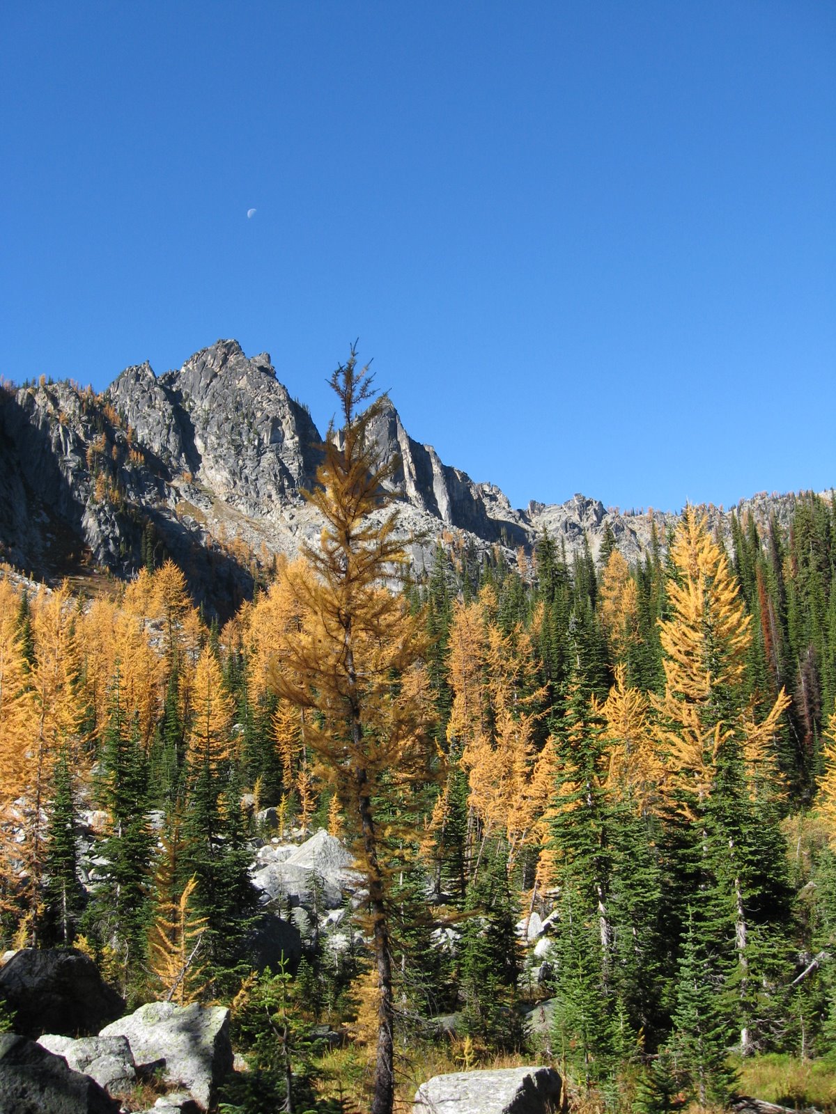
With the fine fall weather hanging around the Koots for a few days, we headed off to explore the trail to Plaid Lake in the hopes of finding more larches in fall color, and, of course, the views.

This being a "rest day" we caught the 8:10 ferry across the Lake, found the right FSR leading up behind Crawford Bay and headed up. The FSR had been partially deactivated which, around here, means big drainage trenches in the road, making a high clearance 4x4 vehicle pretty much the only way to negotiate the holes. In addition to being full of deep trenches, it was steep, so the old truck started to complain near the top. Interestingly, the highest part of the access road was the best, but we walked that bit.
The trail in to Plaid Lake was fine, although the trailhead is higher than the Lake. When we got to the trail downhill to the Lake, I was surprised when Catherine suggested we head up to a nearby ridge for the views rather than hike down to the lake. I guess she's arrived at that stage when she'd rather stand on top of a peak rather than sit by a lake. Who knew?

At the "pass" we were just below Mt Crawford, a prominent peak visible east of Crawford Bay. It's one I'll have to come back to scramble up on another trip.

A short traverse across a steep slope and we were on a minor ridge with views in all directions of the compass. It's always fun to identify all these other peaks, including ones you've been on recently. After some time snacking and resting in the sun, it was back down and off to home. We were surprised by the amount of traffic waiting for the ferry and luckily happened to be almost the last vehicle that made it on for the trip across the Lake.

Thursday, September 30, 2010

Exploring the Koots 0930 - Fletcher Lake and Beyond

Not long after getting home from the Macbeth Trail, and while still restoring my carbohydrate and water balance, I got a call about a hike the next day. The plan was to head to Upper Fletcher Lake (which I've been to before) but to then traverse the Fletcher Basin, climb up to the next ridge and possibly attempt Mt Trafalgar. With blue skies and the promise of fall larches, it was the matter of a few minutes to re-load the pack, make a new lunch and get ready for another day in the hills.

The first challenge was the Fletcher Creek FSR which was getting some attention from the grader. This was probably a good example of something that gets worse before it gets better. Good thing we had high clearance vehicles.
The hike in to Upper Fletcher is quick - only slightly more than an hour, with fall larch color appearing in the woods as we approached the ridge overlooking the Lake. We descended into the valley, crossed through the woods and climbed up to the next ridge, made our way along that ridge and finally emerged to see Mt Trafalgar still quite a ways off. Too far for this day's trip.

We enjoyed the views, the blue skies and tried to identify peaks in the distance before heading back to the trailhead. Just another day in Paradise.

Wednesday, September 29, 2010

On the Ice Again - Macbeth Glacier Revisited

The original plan for the day was for Stu and I to drive up the Glacier Creek FSR and have a look at the Horseshoe Glacier, just across the valley from Jumbo Pass. From the map, it seems like there would be a number of peaks that could be climbed from this glacier, a possibility for next summer perhaps.

The day didn't unfold as we had planned. Forestry was busy replacing bridges on the Glacier Creek road and at Km 30 they had big machines digging holes in preparation for a new bridge. To salvage the day, we decided to head up to the Macbeth Glacier, partly to look at the trail conditions, partly to have a walk around on the glacier and partly because Stu hadn't been up to that area yet.

We discovered only about a dozen trees down across the trail and we only had time for a short walk around on the glacier, but the day was stellar with not a cloud to be seen. We also saw a small bear track in the path on the way up. Hope the bear enjoyed the blueberries that were along the trail. We found the berries a bit past their "best before" date so we left most of them for the bears.

Tuesday, September 14, 2010

On the Trail of Earl Grey - Sept 9 to 13, 2010

The Earl Grey Trail is a historic route connecting the Toby Creek valley near Invermere with the Hamill Creek Valley near the NE end of Kootenay Lake. It's about 60 km in length, crosses the Purcell Range over Earl Grey Pass and is normally hiked in about 5 days. Word had spread that the trail was in good condition this year so 10 of us decided to give it a try. Four of the group drove vehicles to the Toby Creek trailhead and started there while six of us started at the Hamill Creek side.

Information about this trail comes with cautions about changing mountain weather, tricky creek crossings, real backcountry camping, long distances from help, precautions about bears and food storage, steep trails and so on. For the most part, I'd say the route lived up to that information.

Our first 3 days were relatively easy, with 12 km being the longest day of hiking. Distance hiked is only one way to measure difficulty, though, and we found the going slow, with huge logs to clamber over and around, slippery log crossings of many streams, several (5) cable car crossings, muddy sections of trail and wet West Kootenay bushes. Indeed, the entire trail over the 5 days was damp or wet. There were showers, intermittent rain and cool temperatures. Only a couple of brief times did we see the sun.

Camp spots were small and rustic and we spent a certain amount of time at the end of each day drying boots and clothing. Food had to be pulled up into trees in case bears visited our camp during the night. Biffies were the usual backcountry rustic.

The first 3 days were spent hiking up Hamill Creek mostly in old growth cedar forest. It was dark, damp and mystical. Misty too, sometimes. Day 4 we climbed for several hours to reach Earl Grey Pass and admired what views we could with the swirling cloud and mist. The trail then dropped steeply into the Toby Creek Valley. We believe views in this area would be quite amazing, but we saw only low-hanging cloud and mist. We made an impromptu camp in a thick spruce forest where we were able to find some dry areas under the trees to camp for the night. All that remained was a 4-hour hike to the end of trail and the drive home.

This is a challenging trip through remote terrain. Trail conditions were good but rough. Careful preparation is important, keeping in mind changeable mountain weather. The unprepared could find themselves in trouble quite quickly. That said, it's a classic hike through the very remote Purcell Wilderness and well worth doing. Hope for good weather. Pictures live here.