Saturday, December 20, 2008

Ski Season Begins


Yeah, I know, I know. I can hear many of you starting up already: "What's that SkiDoo got to with skiing?". Well, a (sort-of) confession: My town buddy Stu and I went together and got a used snow machine with the intention of using it to get up various logging roads to where all the good ski slopes and and where the snow is usually great. So what you see here is the backcountry equivalent of a ski lift or the winter equivalent of a 4x4 truck.

Today we decided, despite morning temperatures of -20C, to have a look at a hill we skied on last winter. The hill could use a bit more snow. It's been planted so there are new trees poking up all over the place. Mind you, that forced me to practice my turns while avoiding the little trees, and there were stumps that didn't have quite enough snow on them. All in all, though, it was fun for a couple of hours until my skins refused to stick to my skis.

The ride up and back down was not as cold as we were expecting. The person driving has heated handle grips and a windscreen and the person on the back, well, they need to dress warmly! The backcountry ski lift worked well, getting us to the hill in about 15 minutes rather than about 3 hours.

Another advantage of being up high like this is the sunshine. Once you're out of the valleys, you are often out from all the cloud and fog that seems to settle down there. Once again, a chance to see the peaks and views that this area is noted for.

Sunday, December 14, 2008

Understanding Canadian Democracy

The events of the past couple of weeks have been discussed, analyzed, debated and dissected to such a degree that there seems little left to say. So, just to set the record straight....

Not all people living in "The West" support Harper and his government. I seem to be finding more reasons to dislike and mistrust him as time passes.

Stephanie Dion could very well be a great guy, but for whatever reason, he didn't come across to many Canadians as the kind of leader we wanted. He did the decent thing and stepped aside.

It's not "undemocratic" for opposition parties to defeat the government and take power by forming a coalition. It's exactly how our system works. Too many Canadians don't seem to understand that.

Harper and his cohorts have been doing almost nothing but playing nasty partisan games since 2006. Canada needs leadership, not a dictatorship. Quit with the games and get on with consensus building and dealing with the needs of real Canadians. This can be done without every step being a matter of parliamentary confidence or Conservative ideology.

I dislike John Baird (former Environment minister) more each time I hear him, to the point that I will turn off the radio or TV when he comes on. If that guy could actually deal with the issues rather than spout Conservative invective, I would be astonished. Not to mention that he's part of the reason why Canada has been labeled as especially obstructive in all recent climate-change talks. He really needs to learn how to do his job and can the partisan rhetoric.

I am especially disappointed that Harper resorted to playing on national unity fears by whipping up anti-Quebec fervor. This is NOT what our Prime Minister should be doing. He should step down if that's the best he can do.

My final shot? I'm pretty much disgusted with the whole lot of them.

Too Good to Pass Up?

Receiving yet another of these inane missives in my inbox was enough to get me writing again. I know these things have been circulating for years in various forms, but the question is why? Does anyone actually respond to these things? Wouldn't you think these people would just give up after awhile? Even if they have cancer of the lever?

"From Mrs Gladys Emma
ABIDJAN COTE D' IVOIRE05 B.P 107 05 ABIDJAN.

Assalamu Alaikum,

With Due Respect And Humanity, I was compelled to write to you under a humanitarian ground. My name is Mrs Gladys Emma from Iceland , I am 68yrs old,I am married to late Engr. Alahaji Emma Moradi who worked on oil company in Cote d'I voire. before he retired in the year 2002. He died in the year 2005 after a Cadiac Arteries Operation.

We were married for 36 years without a child. And Recently, My Doctor told me that I would not last for the next six months due to my cancer problem (cancer of the lever and stroke). When my late husband was alive he deposited the sum Of $1.8.Million in one of the finance firm here in Abidjan capital of Cote d'Ivoire for safe keeping.

Presently this money is still in the Vault of the finance firm.Having known my condition I decided to hand over this money to an individual,Brother or sister that will utilize this money the way I am going to instruct herein. I want that you use this money according to the desire of my late.husband to help the Less privilaged,orphanages,and propagating the word of Allah. I took this decision because I don稚 have any child that will inherit this money, And I don稚 want in away where this money will be used in an unGodly way. This is why I am taking this decision to hand you over this money. I am not afraid of death hence I know where I am going.I want you to always remember me in your daily prayers because of my up coming Cancer Surgery.

Please assure me that you will act accordingly as I have Stated herein. Hope to receive your urgent reply. Due to the present condition of my health,I was warned by my doctor to avoid receiving or making any call.You can always reach me through this my private email address.

Yours Sister in Islam,
Mrs Gladys Emma"

Saturday, November 15, 2008

Climate Wars

In a bit of coincidence, I happened to find Gwynne Dyer's book Climate Wars in the library a few days ago. The coincidence is finding this book and the recent issue about carbon taxes that I discussed in a recent post as well as the election of a US President who just might reverse 8 years of climate change denial and put America on the road to action in dealing with this impending crisis.

Gwynne Dyer is a well-known author and journalist with a long experience in world events who is now turning his writing skills on the growing climate change crisis. In a series of hypothetical scenarios set some decades into the future, various outcomes for us and our world are examined, based on the science as we know it now and as we think it will be at that future time.

The book was only just finished, containing many interviews with noted scientists and policy-makers done only a few months ago.

It's a pretty compelling story as it sets out the situation we find ourselves in and what our (increasingly limited) options are.

Friday, November 14, 2008

A Taxing Situation

I will admit to being generally left of center politically but a recent position taken by the BC NDP has me reconsidering my options, especially with a provincial election coming up in a few months.

The background starts earlier this year when the BC Liberal government (note - the BC Liberals are more "conservative" than their name would lead you to believe) brought in a carbon tax - the first in Canada. It was small, but generated a good deal of discussion (whining might be a better word).

The provincial NDP, taking the tired but true position of attacking anything the government does, no matter what it is, has come out swinging, denouncing the carbon tax as useless, an attack on ordinary taxpayers and leaving big polluters off the hook. If I wasn't so cynical about politics, I'd be puzzled by this stance. Seems to me that it's perfectly logical to tax things you want to discourage and reduce taxes on things to want to encourage. I can't see why this principle shouldn't be applied to everyone, including the "ordinary taxpayer", especially as we all contribute to the problem of CO2 emissions.

I don't know much about the relative merits of carbon taxes vs the "cap and trade" system, but I get the impression that a carbon tax is supported by many economists. It certainly looks simple to me, especially given that a "cap and trade" system doesn't seem to be as easy (ie: likely) to set up. My annoyance is with political parties that seem determined to use anything as a political football, even when it's something we obviously need to do and even if the solution isn't perfect.

Thursday, November 06, 2008

On the Road to Nowhere

Nothing like believing in Free Markets and less Government intervention, unless, of course, you're in financial trouble. The Big 3 automakers are now seeing the looming recession and high fuel prices cutting into their business in a big way. I like watching BNN's Squeeze Play even though I tend to disagree with some of Kevin O'Leary's attitudes. On the automakers, though, he's right on - let the market decide. GM, Ford and Chrysler have kept engines and vehicles excessively large and inefficient and continue to brag about Hummers and performance. The writing has been on the wall for years and the CEOs of these companies have managed to ignore the message. If they can't compete, let them die, or merge, or whatever.

No Flush of Success Yet

CBC Radio's Spark, one of my favourite programs, carried an interesting segment the other day on water-efficient toilets. Out here in the Kootenays, where we "appear" to have lots of water, we're still fighting the all-too-prevalent-attitude that "the Lake has lots of water in it", that we don't need to meter water use, that water meters only penalize poor people (apparently because only rich people will have the money to waste metered water, I think....) and so on. These conversations and comments remind me of similar assertions tossed my way years ago when I was teaching school students about acid rain, pollution, over-population, recycling, and climate change. We all need to be reminded that many people will resist ANY change in their lifestyle, even if, it appears, it will save them money or conserve natural resources. The concept of trying to find more efficient ways of using these resources is still being portrayed as undemocratic and foolish in some wierd way. Hard to believe in this day and age.

Tuesday, November 04, 2008

Jan 20, 2009 - End of an Error

It was the caption on a bumper sticker we saw in northern California last winter. At the time, I credited my hours of watching The West Wing with giving me the ability to "get it". Tonight, we saw the beginnings of that change. Neighbours organized an "Election Results Party" and included several ex-pat Americans who were pretty excited by the results. I hope expectations get past the unreasonably high stage painlessly, but a new attitude in Washington has got to help. Over the past couple of winters we've met many Americans on our travels. They deserve better than what has been inflicted on them in the past 8 years. It was time for a change and now it looks like they'll get it.

Thursday, October 23, 2008

Weighing in on the Financial Crisis

I don't think there's been nearly enough careful analysis of the probable causes of the current financial crisis. Lots of finger-pointing, but not enough analysis. One pundit I follow has admitted that he doesn't know what the cause might be. Being somewhat of a government interventionist supporter (albeit with small "g" and small "i"), I'm going with minimalist (read: non-existent) regulatory oversight as the root cause, but what do I know?

So, in case you haven't read enough of other's opinions, here is another, courtesy of CBC's Search Engine.

Monday, October 20, 2008

Exploring the Koots 1019 - Nice Lake by a Dam Site


Another bluebird sky day in the Koots, so we did something we almost never do - we went for a drive, simply to see the scenery. Just north of the end of Kootenay Lake is Duncan Dam, built a few decades ago as part of the Columbia Basin Treaty (to maintain water levels for flood control and power generation), which created a much larger Duncan Lake, now 40 km long rather than its original 14 km. We'd never seen the dam, or the Lake, really, and discovered, once again, great scenery, a nice lake and a beautiful campground (BC Forest Service, by the way) near the settlement of Howser.

We extended the drive to go west along Highway 31 to Trout Lake, mostly just to look at the Lardeau River and to see if any Kokanee Salmon were still around, to watch the Bald Eagles, check out the various FSRs that might be useful for skiing or hiking into the Goat Range Wilderness.... We had planned to have a closer look at the campground on Trout Lake at Gerrard, but a grizzly was feeding on some sort of carcass, so we viewed the scene from the truck and moved on.

On the way back home we had a look at the Meadow Creek Spawning Channel, created during the construction of the Duncan Dam, partly to remediate the disruption caused by the dam. It wasn't all the dam's fault, as it turns out: some time during glacial retreat thousands of years ago, impassable falls were created on the Kootenay River, making it impossible for salmon to migrate upstream. This created a species of salmon that became landlocked, but since they still needed a place to lay their eggs, the spawning channel was created. At the right time of year (early fall), literally hundreds of thousands of salmon arrive here in the process of living out their biological destiny.

The day was brought to a satisfying conclusion at a belated Thanksgiving dinner at neighbours - the first of at least 2 such belated epicurean delights, I hope. The resident pie expert here produced 2 masterpeices created from orphan apples collected a few weeks ago before the bears managed to get them. Ahhhhhh.

Thursday, October 16, 2008

Road Trip to Yellowstone National Park, Wyoming


With fall well under way and, we hoped, a bit of time before the onset of winter, we decided to take a quick trip to Yellowstone. The idea was to do some hiking in the Park, some shopping in Montana and some exploring in Idaho. Some of this actually happened....

We tried a different border crossing this time, east of Cranbrook, entering the USA at Eureka, MT. We found a small State Park that still had some campsites open (unfortunately right beside a busy rail line), not far from Whitefish Ski Resort.

On through Missoula for food and supplies and some new tires and south towards the Lewis & Clark Trail, Sula, the continental divide and a very nice little campground in the Salmon-Challis National Forest.

The next day we continued south on Rte 93 over the Divide, enjoying sunny skies and warm temperatures and the Salmon River through North Fork, ID that Lewis & Clark explored back in about 1805.

Part of our route east towards Yellowstone went through a dry, almost desert-like valley, just north of Craters of the Moon NP. Stark and dry would describe this area. That night we found a nice campground along a placid and scenic river in the Targhee National Forest, about an hour from West Yellowstone.

The next few days were spent hiking around all the hot springs, geysers and mud flats that we could find along the road, down into the Grand Canyon of the Yellowstone and on to Mammoth Hot Springs. It was cool, then cold, as a major storm made itself felt, dumping significant amounts of snow on parts of the Park. We spent a couple of days at Mammoth waiting for the storm to pass, finally escaping to the North and the I-90. Many roads were closed, including all in the Park the day we left.

Our choice of routes was intended to get us away from the snow and finally, by the time we got to Missoula again, we seemed to be past it. Some shopping finished out the long day of travel and we only went a short distance south and west before stopping for the night. Once again, we were on the path of Lewis & Clark, crossing the Divide at Lolo Pass and spending several hours following the winding Lochsa River west before heading north again towards Coeur d'Alene. We spent our last night at Heyburn State Park about 45 minutes south of Coeur d'Alene and the next day enjoyed a warm, sunny day for our drive back home, just in time to see the Federal election results.

Pictures of the road trip can be seen at:

http://picasaweb.google.ca/dave.mcc51/RoadTripYellowstoneMontanaIdaho#

Wednesday, October 15, 2008

True Canadian Sentiments

As seen on YouTube, that source of everything cultural....

http://www.youtube.com/watch?v=auVGvM4_9XU

Turning Up the Heat

There was a Dennis Lee poem that we used to read to our kids when they were little. In part, it goes like this:

I threw my bratty brother
In the furnace nice and neat
I can't wait until December
When Dad turns on the heat

Dennis lives in Toronto, not Vancouver, and we were always amused by his use of "December". Most places in Canada, that month should be replaced by "September".

That poem was running through my head this morning as I hustled around building my morning fires. It was only +12C in the house this morning. Yup - the heating season is here.

The Morning After - Election Hangover

So much for democracy in Canada.

Canadians have, thankfully, denied Harper the dictatorship he was seeking, but only barely. Commentators are already bemoaning the low voter turnout, at 59% pretty much the lowest on record. Various reasons have been run up the flagpole, but I don't think you need look much further than the results. Consider this:


Conservatives 143 seats - 37.6 % of the vote
Liberals 76 seats - 26 % of the vote
BQ 50 seats - 10 % of the vote
NDP 37 seats - 18 % of the vote
Greens 0 seats - 6.8 % of the vote
Independents 2 seats - 0.65 % of the vote

Some low-level arithmetic will illuminate the fact that the number of seats won has no connection with the will of the people (aka - the popular vote). Consider one simple alternative. If there were true proportional representation, this is what the new Parliament would look like (approximate because of rounding issues I didn't want to deal with at 6 am):


Conservatives - 116 seats
Liberals - 81 seats
BQ - 31 seats
NDP - 56 seats
Greens - 21 seats
Independents - 2 seats

What's stunningly obvious is that Canadians DIDN'T ELECT A CONSERVATIVE GOVERNMENT. The vast majority of Canadians, 51% of them, voted for a left or centre left choice (Liberals, NDP and Greens). There's where Canadian sentiments obviously lie. If you add the BQ to that, the majority would be over 60%. I know that regressive, right-wing dinosaurs out there will belch fire over this, but, other than in Alberta, that's what Canadians are in their souls, like it or not.

(Even in Alberta, proportional representation would have sent only 17 Conservatives to Ottawa along with 2 Greens - oh the horror...).

I pulled the following numbers from a comment on the CBC's website:


Here's a breakdown seats per population (approx)
NFLD: 7 seats. 1 per 72,610 of population
NS: 11 seats. 1 per 85,087
NB: 10 seats. 1 per 75,152
PEI: 4 seats. 1 per 34,852
QUE: 74 seats. 1 per 104,655
ONT: 106 seats. 1 per 121,621
MAN: 14 seats. 1 per 85,449
SASK: 14 seats. 1 per 72,153
ALTA: 28 seats. 1 per 125,441
BC: 36 seats. 1 per 123,009
There are two things that seem broken here. First, the will of Canadians isn't being represented in our House of Commons. Second, the principle of "one person, one vote" isn't even close, and since I live in BC, I'm particularly steamed. Only Alberta fares worse than us.
If politicians are really concerned for the survival of democracy, then it's time they put their self-serving interests aside and fix what's wrong. Oh say, can you see (what it is?).

Monday, October 06, 2008

It's the Election, Stupid

And the election should be about the economy, the environment, health care, hospital waiting lists, government oversight, you know - important issues. But what's it been about mostly? Sweater vests, how well or poorly a given candidate speaks English, and so on. Stupid stuff.

Canadians should be angry that any politician would use the environment to try and score points against a political opponent who is insisting that a carbon tax is necessary. Canadians should be furious that (Conservative) government cutbacks to food inspectors could be the cause of more deaths from contaminated food. Canadians should be fearful about the economy, especially since laissez faire government oversight was mostly responsible for the mess in the USA and which has already spilled over into Canada, remembering that the Harper Government basically espouses the same governmental hands-off approach that got the Bush regime into trouble. And Canadians should be prepared to punish the Conservatives for not daring to release their political platform until after many Canadians have already voted.

Election day is October 14. We will see if Canadians have woken up by then.

Premature Passages


This past week brought with it sad news. From a few of my former students I learned that two other former students had died, both within days of each other.

Gwen was one of my students from about 25 years ago, so far back that I can barely remember the time. More recently, she worked in my old school as a Teacher Assistant, mostly with the Kindergarten kids but also as a Special Education assistant, tutoring older students. As a colleague, she brought a sense of humour and a special rapport with students that I valued, especialy during my last 4 years in the school, when I had time to wander into the Kindergarten classroom to see what was going on. Gwen had just quit her job in Landis and was starting back at University to get her teaching certificate. Diagnosed with heart disease some time ago, something I didn't know about, she died in her sleep about 2 weeks ago. Gwen was only in her late 30s.

I hadn't heard or seen much of Blake for about 8 years, pretty much since the time he left school under rather difficult circumstances. School was hard for Blake and in the traditional school setting, he was often in trouble of one sort or another. In the right situation he had many talents, mostly a keen mechanical ability and a hands-on curiosity about "things". I remember him displaying a restored antique John Deere tractor at school one day. Under the tutelage of a local farmer, he'd completely rebuilt this machine to original working order. When he was younger, he'd come to chat, always with questions about some piece of equipment that he'd dismantled. He died in a motorcycle accident about 2 weeks ago, only 24 years old.

Two deaths of young people from a small prairie town that I worked in for 28 years. It reminds me that you never know how long you'll have to do the things you want.

Sunday, October 05, 2008

Monica Meadows Revisited


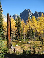
We took the opportunity a few days ago to revisit Monica Meadows, especially since fall is starting to show its colors.

The picture shows it all: golden larches, contrasted with the dark rock of surrounding mountains, bluebird skies, glaciers all around, weathered wood and the fall meadows.

It's just such a priviledge to live in an area as beautiful as this.

Pictures live at: http://picasaweb.google.ca/dave.mcc51/FallInTheKootenays##

Friday, September 26, 2008

The Bugaboos - Briefly


It's taken years to finally arrange a visit to the Bugaboos but it finally happened this week. An ACC work crew was to visit the Conrad Kain Hut in late September to winterize the place. This was the opportunity to make a brief visit.

I managed to convince my regular scrambling/hiking partner that she would find the trip interesting, so we headed up over Gray Pass to Kimberley, up the Columbia valley to Brisco, drove 50 km up the Bugaboo Creek FSR, camped in the truck overnight and made ourselves ready for the helicopter and the day's work. All this to get to a place that is only about 100 km from our house, if only we could travel as crows do....

The rest of the crew and the helicopter arrived around 10 am, two groups were flown into the Hut and then the job of ferrying out the full biffy barrels, in with the clean barrels and the rest of the gear. This day, Tuesday, had perhaps the best weather of the trip, as it snowed and fogged most of the rest of the time.

Catherine and I took the opportunity right away to hike up to one of the campgrounds located about 30 minutes uphill from the Hut, with great views of Snowpatch, Bugaboo Spire, Crescent Spires and Eastpost Spire. All impressive granite spires rising nearly vertically from the surrounding glaciers.

We spent about 2 days taking apart the water turbine, cleaning, installing shutters on windows and trying to keep warm. Thursday morning we finished up and hiked out, taking under 2 hours to make it to the parking lot. This gave us lots of time to make the long trip south, around via Cranbrook and Creston and back home.

Pictures are at: http://picasaweb.google.ca/dave.mcc51/TheBugaboosWinterizingTheKainHut#

Friday, September 12, 2008

Exploring the Koots 0911 - London Ridge


Having searched for the beginnings of this trail a couple of times and needing a way to avoid all the 9/11 anniversary coverage and since it was a great day and because we could....it was London Ridge on Thursday.

A quick drive towards New Denver brought us to the "summit" at Bear & Fish Lakes, elevation around 1100 meters. An hour of uphill hiking through the trees brought us into more open terrain. Another hour or so landed us at the actual ridge, elevation around 2250 meters. Views were great in all directions, from Alps Alturas just across Kane Creek to Mt Loki, about 41 km away across Kootenay Lake. Other nearby peaks were prominent: Whitewater Peak and Mt Brennan, and we could see Mt Reco, only about 7 km away to the south. Once again, it was great to hike without smoke haze obscuring the views.

Colors on the ridge were excellent, with the blueberries and huckleberries an intense red color, along with the various shades of greens from the mountain avens, grasses and mosses.

London Ridge was explored for minerals in its past; the access road we hiked was an old mining exploration road, rather than the usual Forest Service Roads we usually drive. Old scars from the digging in various places was visible continuously after we left the trees. The open slopes seems like they would be great for skiing, though, so I'm sure I'll be back once that season arrives.

Wednesday, September 10, 2008

Fruit Harvesting in the Koots

Around here, I spend some time searching out abandoned apple trees and try to harvest the fruit before the wildlife gets it. During my quest for fruit yesterday, I had an interesting encounter.

Approaching one tree, I was mildly surprised when a small black bear started climbing down the very tree I was going to inspect. He stopped half way down and kept a pair of beady eyes on my approach. I decided that he was more worried about me than about protecting his apples. I decided, however, that a diplomatic move would be the best choice of action on my part, so I changed course and headed away from his tree. As I moved away, the bear came down further and continued to watch me from the base of the tree. You could call this a standoff, but the bear did end up with the tree, for now!

Road Trip BC - Clearwater/Mt Robson


We made what seems like an unusual trip for us, a brief road trip "outside" of the West Kootenays. There just seems so little reason to leave....

However, last week we headed for the North Thompson area and Mt Robson for a family gathering. The plan was to help Catherine's 87-year-old dad hike out from Berg Lake, a 23 km distance.

First, we got as far as Clearwater, where we were going to spend the night with an acquaintance and do a hike. Where, coincidentally, the car rejected the fuel pump. So, while the car was being repaired, we hiked in to Trophy Meadows, in the southern part of Wells Gray Provincial Park. The flowers were well past their peak, but the alpine meadows were among the most extensive I've ever seen. This is a place we'll want to visit again.

Then it was on to Mt Robson. Unfortunately, the weather didn't cooperate, so there were no helicopter flights in to Robson Pass the day we had booked. We did, however, use the next day to hike about half-way in to Berg Lake so Don got his long hike into some pretty nice scenery. I figure for age 87, he did pretty well, hiking about 24 km that day.

We headed home the next day, taking a shortcut around Kamloops, along Adams Lake, down into the Okanagan and over Monashee Pass and back into our beloved Kootenays.

Pictures of the road trip live at: http://picasaweb.google.ca/dave.mcc51/RoadTripClearwaterAndMtRobson

Monday, September 08, 2008

Election Eh?

Well, now we have it. A completely unnecessary election. What is it, the 3rd in 4 years or something stupid like that?

The Conservatives may actually win this one given the absolute and complete ineptitude of the other parties, but I really hope voters remember a few things when they go to the polls:

The Conservatives LIED about how they would deal with Income Trusts, and the evidence brought forth since that action 2 years ago just shows how wrong they were.

The Conservatives are planning (or were, since the election call will postpone the legislation) changes to the Copyright Act. There is overwhelming evidence that these people don't have a clue about the "Information Age" that we've been in for the past 2 decades. One of my favourite blogs has been documenting the proposed bill's shortcomings.

And, perhaps even more importantly than the previous issues, this government hasn't done a single serious thing about the growing environmental and climate change crisis. In fact, they've been obstructionist. Hard to believe in this day and age....

Canadians were worried that Harper had a hidden agenda when they gave the Conservatives a minority government last time. I think we now have real reasons to be worried.

Join the movement.

Monday, September 01, 2008

Exploring the Koots 0901 - Krao Lake


The local hiking group had an objective in mind for today and, against my better judgement, I went along. The objective was Krao Lake, high up in the hills above Ainsworth with great views down to Kootenay Lake and interesting ridges to follow above the little lake, but things didn't quite go as planned.

I didn't think the weather looked all that good. Sure enough, we no sooner left the vehicles than it started to rain. Actually it was cold enough that it was almost snow.

We perservered through the woods for nearly 2 hours, arriving at Krao Lake. It's a cute little lake, set in amongst rocky ridges. Many years ago it was damned (dammed?) I believe for some mining purposes lower down. The dam has been gone for years so we enjoyed the views of the lake and the sun which decided to make an appearance and entertained thoughts of hiking/scrambling around the lake. Did I mention the new snow visible on the nearby hills? Anyhow, it started to snow/rain again, so the lake circuit was abandoned in favour of heading back home. More exploring for another, and nicer, time.

Sunday, August 31, 2008

Exploring the Koots 0831 - Mt Reco


One of the great advantages of living where we do is the opportunity to look out the window and decide whether we'll bother going for a hike on any given day. This morning we saw our relatives off and started pondering the skies. Thinking that things looked OK, we headed for Jackson Basin and the minor peak of Mt Reco (elevation 2530 m).

A 20-minute drive or so brought us to Retallack, and a 9 km drive up the Stimson Creek FSR brought us to the end of what our truck could handle (elevation 1800 m). A further 90-minute hike up a mining exploration road to a ridge and from there to the summit of Mt Reco rewarded us with views in many directions. Skies were mostly cloudy, but there were patches of sunlight on slopes and ridges in the distance. Slocan Lake was visible to the SW, and there were good views of Idaho Peak, London Ridge and another peak to the East that we want to do sometime, Texas Peak. We were also able to see the trailhead to Alps Alturas, a hike we did a couple of weeks ago. In a few of the valley bottoms were the buildings of several mine sites not far from Sandon.

Temperatures were quite cool up high, probably not far above freezing, and to remind us of this, we were treated to a small bit of snow. We took an alternate route down some open slopes to another exploration road and then back to the truck. On the way down the FSR, the rain began more in earnest but it was over before we arrived back home. For the day, an elevation gain of about 700 m. There was lots more, but it was done in the truck, so I guess that doesn't really count ;-)

Exploring the Koots - 0830 - Three Forks to New Denver


We had an easy hike today, one we've done before: the Galena Trail along the Carpenter River from Three Forks to New Denver. We had relatives visiting from Alberta, casual hikers unaccustomed to the rather severe elevation gains of many trails in the Kootenays, so we picked this one.
The trail mostly follows an old rail line from New Denver up a narrow valley towards Sandon, the site of old (and current) mines. A side trip at Alamo Siding took us past the collapsed mine site to the mine manager's house, now mostly falling apart and being reclaimed by the forest.
A short ways down the trail you come to a small cable car that carries you, and your bike, across the river. It's a pleasant trail, and since it was once an old rail line, it's quite flat, gently descending down the valley towards New Denver.
One the way back home we checked the location of a trail leading up London Ridge, a hike for another day.
I have to say that the smell of fall was in the air. We've had unseasonably cool weather recently and have seen a bit of fresh snow on the peaks across the lake. Although the cool weather does put a spring in your step as you hike along the trails, I do hope that the fall season warms up a bit and settles down. I'm not quite ready to pull the skis out just yet!


Saturday, August 23, 2008

Mt Loki at Last


Finally, a day to climb Mt Loki. I've mentioned this peak a few times in my blogs - a West Kootenay classic, easily visible and prominent across Kootenay Lake from Kaslo and one I've wanted to climb ever since we moved out here.

A small group from town decided to "do" the peak today so I got my neighbour to come along with me and we headed over last evening. In typical form, we took the ferry across the lake, drove up the FSR on the east side of the lake and followed the Portman Creek FSR to the top. This recently developed route eliminates hundreds of meters of sweaty elevation gain. After a quiet and cool night in the woods way above Kootenay Lake, and some breakfast, Bob and I started off. The rest of the group would be some ways behind us, having only left Kaslo early in the morning to catch the first ferry across the lake.

In about 2 hours, the peak was well in view, but it was nearly 4.5 hours to the summit, with some wandering around here and there searching for the best route through all the rubble and the rock bands and false summits.

This day there were 10 people summiting as well as one dog. I'd rate the difficulty as a mild moderate. There is some mild exposure, some route finding, some easy slabs and lots of elevation gain.

After lunch on the top, we headed down, taking 3.5 hours back to the truck, in lots of time to zip back down the hill and on to the ferry at Kootenay Bay, getting us back home in time for a beer and supper.

Pictures of the day can be seen at: http://picasaweb.google.com/dave.mcc51/MtLoki

Tuesday, August 19, 2008

Exploring the Koots - 0818 to 0819 - Double Header


Ignoring the heat we've had for the past while, or perhaps hoping for relief further north, we headed off Monday morning for a trip up the Glacier Creek FSR. Our objectives over two days were the Macbeth Icefields and Monica Meadows.

Monday was really far too hot for civilized hiking, but we perservered and did make it up to the view in the first picture - that of the falls coming from the melting Macbeth Icefields. We decided not to continue up to the toe of the glacier, having seen many similar things, postponing that little delight for another (cooler) day.

The main complaint about this trail was the substantial deadfall. I can handle the elevation gain (somewhat in the order of 1000 m), the steepness of the trail and even the alder (I lopped growth all the way up and back), but the 115 logs that we had to clamber over was a bit much. The trail really needs a trail crew with several chainsaws. I'm not kidding about the number of logs - Catherine kept count, and she has the bruises to show for many of them.

Monica Meadows, our Tuesday hike in much cooler weather after a night of fun lightening and rain, was considerably more pleasant. A nicely graded trail with real switchbacks, no deadfall and only an hours walk to the start of the meadows. Great views across the valley to mountains and glaciers of the Macbeth Icefields, southwest to the Horseshoe Glacier, and east to the peaks separating us from the Jumbo Pass area. It was an excellent finish to our two-day excursion.

Pictures of the trip live at: http://picasaweb.google.ca/dave.mcc51/GlacierCreekFSRMacbethIcefieldsMonicaMeadows

Saturday, August 16, 2008

Exploring the Koots - 0815 - Alps Alturas


One nearby alpine area that we'd been hearing about for some time now is Alps Alturas, located NE of New Denver high in the mountains on the edge of Goat Range Provincial Park. With the weather clear, hot and dry, and with none of the usual mid-summer smoke haze in the air, we decided ato make Friday the day to explore this new area.

Nearly an hour brought us to the Wilson Creek East FSR for the start of a further 25 km of climbing to the trailhead on the border of the Goat Range. Thankfully it got a bit cooler as we climbed but another vehicle accompanying us couldn't handle the grades without overheating, so they turned back.


By 10 am we were ready to hike with about 500 m of elevation gain remaining. Even arriving at the trailhead was scenic, with the FSR edging around large mountains with incredible vistas opening up below us and into the distance.

A short hike through the woods brought us to lush alpine meadows and increasingly fantastic views in almost all directions. The trail curved around the base of Mt Dolly Varden and on to a lake at the base of Mt Martens. We had clear views to the Denver Glacier in the Valhallas and the glacier and peaks of Kokanee Glacier Park in the distance, and the myriad of other peaks in all directions.

Having scrambled to the top of a minor hill and enjoyed our lunch amid all this scenery, we hiked back down, rattled our way down the FSR, cooled off in the waters of Slocan Lake and headed for home.

Thursday, August 14, 2008

Bushwacking the Koots - 0813


I had the chance Wednesday to go for a hike with one of the more longer-time locals, someone known for long bushwacking routes into the Kootenay backcountry. Knowing this in advance, I was able to be somewhat skeptical when I was told that we'd be back by 3 pm and that it was "just a hike" up an old mining trail in the Sturgis Creek drainage. I packed some extra food, carried my headlamp, gaiters and brought the bush loppers, an apparently essential piece of Kootenay hiking equipment.

We traveled up Keen Creek and into Kokanee Glacier Provincial Park (this is the north "entrance" which is seldom used these days). It took some time to even find the old mining trail as it was very overgrown and the beginning wasn't obvious at all. Using the map, the GPS and Tom's memory, we eventually found the place and, loppers in hand, headed up the "trail".

In the Kootenays, any trail not used much soon grows over with Devil's Club, Thimbleberry, stinging nettle and lots of alder. Not to mention cedar, fir and spruce seedlings on their way up. Add to that regular deadfall to crawl under or over. We traveled slowly, clearing a trail as we went. After several km, the trail narrowed somewhat, but actually improved - you have to admire these early 1900s miners and the trails they built into this kind of country.

Eventually, we reached the old mine site: a couple of decaying log buildings and the refuse of mining in a bygone era. Another 500 ft higher in elevation was supposed to be a lake, so up we went, nearly straight up - clinging to branches and what stable rock there was. The lake was very nice, very peaceful, and we were literally only just "over the hill" from the Silverspray Cabin. If we had climbed to the top of the next hill, we would have been able to look down into that valley. As it was, though, we had gained over 1000 meters of elevation and didn't feel like adding the extra hill to our daily total.

All of this, including a lunch break by the lake, took from about 7:30 am to 1 pm. Heading down was easier since we now had a trail and gravity was working for us. We were back to the vehicle in less than 2 hours and back in town by 3:30 pm. Not bad for a day of bush thrashing in the Kootenays.

Monday, August 11, 2008

Exploring the Koots 0811


Feeling almost sufficiently rested, I agreed to a Monday hike headed for Mt Reco, at the end of Jackson Basin, south of Retallick. The rain seemed to have ended although clouds remained which we hoped would dissipate during the day.

The first bad news was that the FSR leading to Jackson Basin was being torn apart by a backhoe so that route was blocked. Then we tried to find the trail up to London Ridge, but despite an hour of bushwhacking and casting about here and there, we were unable to find anything that headed uphill.

We finally headed for the FSR up Kane Creek, near the road to Sandon. Apparently this trail/road used to provide an alternate access to the Alps Altura area that we plan to try later in the week. We decided to hike up the road (driving was prevented by a rotten bridge) to see what we could see. Mostly wet thimbleberry and alder and a walk in the woods. We hiked up about 5 km until a large mud slide and downed trees basically rendered the trail unusable and very overgrown. In the distance we could see the beginnings of what we thought we were looking for, but we weren't going to get there on this trail. Having had enough of this fun we headed home, with one last look for the trail to London Ridge - no luck, again.

Sunday, August 10, 2008

Asulkan Pass - Another Week in the "Hills"

I just returned from a week working at an ACC camp at Roger's Pass. This was the "55+ Trekking Camp", this year running out of the Asulkan Hut, near Asulkan Pass, over a km higher than Roger's Pass in the mountains to the south.

This was supposed to be a "Trekking" camp, but for future reference, there is zero "trekking" from this Hut - it's either glacier travel and climbing peaks or nothing, other than the trail back down (that's "way" down) the moraine.

This camp is generally thought to be more "laid-back" than some of the other camps, but we regularly had super weather, 10 to 14 hour days and many, many meters of elevation gain and loss each day. The weather was so good we had difficulty using one up for a "rest day", so by the end of the week we were all getting pretty tired.

The area around the Asulkan Hut is probably best suited to winter skiing - the terrain here would be absolutely fantastic for that activity. There are peaks to climb in the near vicinity, but for a moderately-paced group, there isn't all that much to do. We did, however, climb nearly everything there was available to climb in the area, trudged over vast acres of glacier, visited Asulkan and Sapphire Cols, and generally got a good visit with the area.

Yes, I have pictures, and they live at: http://picasaweb.google.ca/dave.mcc51/AlpineClubOfCanadaAsulkanPassCamp

So now I'm tired and enjoying, finally, a rest day here at home.

Thursday, July 31, 2008

Mt Loki - Just a Little Bit Closer


Had an opportunity today to be part of a trail crew working on a new route towards Mt Loki, a prominent peak just across the Lake from us and one I've mentioned before as being high on the "to do" list.
In typical West Kootenay style, the group drove by our road just before 6 am this morning, we caught the 6:30 ferry to the other side of the Lake, drove up a Forest Service Road on the east side of the Lake and climbed to the top of a "hill" on the Portman Creek FSR. The "new" trail to Mt Loki started there.
For several hours, we trimmed branches, hacked and dug rocks and generally made a trail where only a flagged animal path had been before. I took about 45 minutes before our hike out to hoof it up to "the Notch" where I was rewarded with a great view of the final route up Mt Loki. Probably another 3 hours of climbing, by some accounts. Now that I know the route, it's even higher on my summer "to do" list.
Then it was back down the new trail, down the hill, across the ferry again and back home in time for a badly needed shower, a brew and some food. Another day in the Koots.

Wednesday, July 30, 2008

Exploring the Koots - the Valhallas - Gwillim Lakes


A couple of weeks ago, Catherine decided that we had time between my mountaineering trips to manage a quick backpacking excursion in to Gwillim Lakes in the southern part of Valhalla Provincial Park. She managed to coax a few friends along too, so on Monday, we set off.

In typical Kootenays style, we drove over to the next valley west of us, where Slocan Lake lives, followed a couple of Forest Service Roads about 40 km from the highway and arrived at the trailhead a short time before lunch.

After packing up and having a mid-day snack, we set off. The hike in was fairly steep, but very scenic, up to Drinnon Lake on the Park boundary, up to Drinnon Pass, down into a deep valley and finishing off with a steep climb in to the large cirque that contains the Gwillim Lakes.

The lakes are almost more like apline tarns with the "campground" consisting of a few tent pads scattered around in the meadows and boulders surrounding the lakes.

The next day we decided to scramble up to higher ground surrounding the Lakes and follow along below Lucifer Peak and a few other hills in the Devil's Range. Great views down into the Gwillim Basin and to peaks beyond our location. Back to the campground for a snack and a snooze. The weather was signalling change, so we had our supper, packed up and headed back to the trailhead, taking just over 2 hours to return. A leisurely drive back home with a brief introduction to another small gem in our hiking area.

Pictures can be seen at: http://picasaweb.google.ca/dave.mcc51/ValhallaProvincialPark

Thursday, July 24, 2008

Another Great Mountaineering Trip


Just returned from a few days attending the Saskatchewan Section's Mountaineering Camp in the Little Yoho Valley of Yoho National Park. This year we had the Stanley Mitchell Hut which certainly made for more comfortable accommodations.

In this picture is the route up the President Glacier to the "col" and then up the right-hand ridge to the summit. This year, the snow conditions presented a few challenges. For one thing, the final approach to the col now consists of a fairly steep, somewhat exposed, thinning snow bridge between a yawning crevasse (the bergschrund) on the left and another developing chasm on the right. The situation certainly focussed the attention!

The days on the camp were spent instructing beginners to this form of recreation - things like crevasse rescue, self-arrest, kicking steps up snow slopes, knots, roped travel over glaciers and scrambling up rocky ridges. Our weather for the camp was pretty much what you see in the photo - clear, blue skies and increasingly warmer temperatures as the week developed.

It was a great week. I'm back home for a few days of rest before further mountain adventures.

Tuesday, July 15, 2008

Exploring the Koots 0713 - True Blue


The Sunday hike this past weekend (I use the term "hike" loosely) was to the summit of True Blue Mtn. True Blue is the very prominent mountain behind Kaslo and, given it's prominence, you'd expect a good trail to the top. Such was NOT the case, however. The day was 10 hours long, involved about 1700 m of elevation gain (only a bit of it on a logging road), substantial bushwacking, some route-finding and some pretty serious uphill.

The group for the day was a good size - I didn't really count, but there were probably 15 or more of us who started out at 8 am. The start was in traditional West Kootenay style - 4x4 logging road uphill for about 4 or 5 km. After that, it switched to a very old mining trail, then to a faint trail that headed straight uphill - not a switchback in sight! Add substantial deadfall and alder thickets to the mix.

The rewards at the summit (after several false summits) were worthwhile with great views up and down the Lake, Howser Spire (in the Bugaboos) in the far distance and many other peaks in the near vicinity. That said, I don't think many of us would jump at the chance to go up there again. The way down was almost as hard, although we did try a "shortcut" down through an old logged-over area which was probably a bit quicker and easier. Beer and a shower at home was much appreciated after the day.

Sunday, June 29, 2008

Exploring the Koots - 0629 - Whitewater Creek


The objective today with the Sunday hikers was Whitewater Creek. This is another great place to backcountry ski in the winter and a good place to see grizzly bears at this time of year.


Today was a semi-scorching hot day, with early afternoon temperatures rising to near 30C and not a cloud in the sky. Much of our trail was in the woods and later on an east-facing slope with much rock and some snow patches so it wasn't too bad. Numerous small, cold streams provided the opportunity to cool off.

We saw one grizzly across the valley, foraging for food on the hillside - a large male from the looks of it.


We stopped once we had a view of Whitewater Mtn, shown in the lower picture. It's the peak with the snow cap just left of center. Apparently it's a scramble with some exposure. Right now, there are a couple of large cornices along the route. Perhaps later in the season.

Exploring the Koots - 0622


We took a couple of hours on Sunday to do a walk from Amundsen Road to Fletcher Falls and back, only about 5 minutes from our place.

The start of the walk got increasingly nice, walking along what used to be the main road between Nelson and Kaslo. It rose gradually, resulting in a great view of Kootenay Lake far below.

The trail passed right under the deck of a very nice older couple where we stopped to chat for a few minutes, then down to Fletcher Falls. At this time of year, the spray from all the water pounding over the falls is quite impressive for a small set of waterfalls. One of our local gems.

Tuesday, June 17, 2008

BOB


Yes, it's the bridge: Bob - stands for Big Orange Bridge. It spans the Kootenay River at Nelson and makes a pretty good landmark from the hills of Nelson.

Some years ago, before BOB, there was a ferry across the river at this point. The Kootenay River is what drains Kootenay Lake, although the river itself rises in the Rockies in Kootenay National Park. The river then flows south and west, passing near Cranbrook, into Kocanusa Lake, down into the USA for a bit, then back north into Kootenay Lake, down past Nelson and finally joining with the Columbia River on its run to the Pacific at Portland. Nice river.

Kootenay Kactus


I know, I know, it's pretty wimpy, but I'm pleased with it so far. This is one of my Arizona imports from our winter trip south. I brought home a couple of "cuttings" from some of the many cactus plants I saw on the desert, stuck them in some gravel and waited.
Around here it's going to have to live it's life as a house plant, but it's been doing well. In fact, just last week this little guy started to bloom. I guess it was happy that it was finally getting some sunshine in that south window I've had it in.
I have a small selection of little cactus plants growing now. One I especially like is the Teddy Bear Cholla. It's sending out new growth now too.

Sunday, June 08, 2008

Exploring the Koots 08/06

The destination of the day was Fishook Lake. Meeting up with a group from Kalso who hike every Sunday, we drove about 20 minutes north along Kootenay Lake to hike the Davis Creek Trail. Fishook Lake is a small lake reached after a 2-hour hike up a very steep trail and through thick forest.

The trail isn't noted for great scenery, being as it is located in rather dense forest, it does afford some great vistas out to Kootenay Lake and the mountains to the East. Fishook Lake itself is small, presumably shaped like a fishook and otherwise unremarkable.

However, it was our first experience with these Sunday hikers, and it seems like there are some good possibilities for future excursions. Having a source of local knowledge seems pretty important here in the Koots. The hike up the steep trail was good as well - great exercise. All the better being able to be back home by late afternoon to a nice shower, some wine and a great supper.

Tuesday, May 27, 2008

Water woes

One of the unique features of our lives here in the Koots is that we (ie; our community) look after our own water. It's a bit more than the well you might have been used to in your youth. We have two submersible pumps in the lake lifting water to a treatment building where we chlorinate and filter the water as it moves to a reservoir. We're talking fairly major equipment here.

Anyway, the other day, two of the volunteers discovered that the lake pumps weren't coming on when it was time to fill the reservoir. The crew (several of the more experienced neighbours) was called out to troubleshoot. During the examination, a cracked gate valve in the lake pump house was discovered. This meant that the whole system had to be shut down and that two of us got to spend most of Monday morning taking apart some of the pieces you see in the picture to replace the leaking valve.

Saturday, May 24, 2008

We're From the Government....

We may be days away from seeing the new Copyright bill introduced in the House of Commons by Industry Minister Jim Prentice. This bill could contain many things that will be bad for the Canadian consumer, for education and for Canadian business. Until the legislation is introduced, we should occupy some of our time by becoming familiar with the issues. One of the best places is Michael Giest's blog. Once the bill has been introduced it will be clear whether the Government has listened to Canadians or to the American Government.

Thursday, May 22, 2008

Off the Grid


There are places in rural, mountainous BC where people live, by choice and by necessity, "off the grid". No power poles nearby to supply what most of us take for granted. No phone lines. Communication by satellite phone or radiophone, transportation by boat or rough logging road. This choice of lifestyle comes with many challenges, as you can imagine, and with the advantage to live where you want, lives of semi-isolation, peace, quiet.

We visited some people in one such area during a recent visit to Fry Creek Canyon. The work they've done to develop homes in these areas away from commercial sources of power and away from ready access to supplies is quite amazing.

It was a splendid day with isolated showers and misty, moody views out over Kootenay Lake. It could almost be the Pacific Coast, a feeling I've had many times around this lake and others in these deep mountain valleys of the Kootenays. Snows are melting more rapidly in the hills above us and "creeks" are now raging torrents. The level of the Lake has come up dramatically in the past week as numerous rivers and creeks pour out their contents. Summer is on its way.

Sunday, May 18, 2008

That Dammed River


We went for a short hike Friday in Syringa Provincial Park just up the Columbia River from Castlegar. The park is on a part of the River called Lower Arrow Lake, said lake formed by the Keenlyside Dam. There are 14 dams on the river, this dam being the smallest of the lot and one of three on this river in Canada. You might be interested to know that the 14 dams generate a total of about 24000 MW of electricity. Not much wild river left here.

Castlegar is where the Kootenay River (coming from Kootenay Lake) empties into the Columbia River.

Burma - Myanmar - A Dictatorship by any Other Name...

Today's CBC Radio program, The Sunday Edition, takes a look at whether aid should be delivered to the Burmese people regardless of the intransigence of that country's "government". More information is available from the CBC's website. This is a country where it's own government won't or can't help disaster victims and continues to refuse outside help. Do we use the rather tenuous principle of respect for a nation's sovereignty to do nothing or do we move in to help despite everything the military junta is doing to prevent outside aid from getting to the people affected by this disaster?

Tuesday, May 06, 2008

The Hummer's Return


We got one more sign of spring and impending summer in the past couple of days: the hummingbirds are back. On Sunday, we saw one zooming around the yard so we hurried to put up the feeder, hoping that it would stay around if it found food. So far, so good.

Right now, we have a pair of very tiny Rufous Hummingbirds coming to use the feeder regularly. I haven't figured out how to get a decent picture of something so small, and it won't let me get all that close, so this is the best I've been able to do, so far. We're expecting to see some Black-Chinned Hummingbirds back this year. They were around all last summer, but so far they haven't arrived. The Rufous hummer is a kind of rusty brown with what looks like a black patch under the chin. If the light catches that patch just right, however, it's the most fantastic irridescent red color.

Other birds gathering at the nearby seed feeder include numerous Pine Siskins, some White-Crowned Sparrows, Chickadees and Nuthatches. Other than the hummer, most of these birds don't really need food supplied at this time of year, although spring has been delayed by several weeks. Only in the past week or so has it been decently warm, and then only a few times. Hopefully we have turned the corner and are on the way to more seasonal weather for this area.

Tuesday, April 08, 2008

The Political Olympics

The Olympic Torch relay seems to be encountering significant levels of protests. On the one hand, it's disappointing that politics has to pervade everything, including sporting events, but on the other hand, it's naive to think that anything can be separated from current and historical events.

Personally, I'm pleased that the Olympics will be taking place in China this year. China, it's people and leaders, need more exposure to the outside world, not less. Perhaps with more interaction with the rest of the world, China can come to realize that (recent actions of the US government notwithstanding), old ideas of imperialism, empire building and repressive military actions rightfully belong in the past and that the majority of the world's people oppose them.

Anyone more interested in why China's midset seems to be what it is could read an intesting book: Daughter of China.

Let the Olympics continue and let them be in China. Let everyone attend.

Free Tibet.

Monday, April 07, 2008

Even More "spring" skiing

Oridnarily, I'd be quite ready to avoid more snow and quite happy to get into spring mode, but I got this phone call....

How would I like to spend a week, for free, at the ACC's Fairy Meadows Hut. The only conditions: I had to get ready for a week in the remote mountains in 2 days, and I had to do some serious mold cleanup and hut maintenance. I hummed and hawed for a couple of hours, but finally the offer was too good to turn down. I hustled around getting my food ready - leftovers in the freezer were pressed into service, skis and winter clothing was rounded up "again" and at 5:10 am March 29, I was under way. Four hours got me east of Roger's Pass to the staging area. The helicopter arrived shortly before noon to take us about 20 minutes up Kinbasket Lake into the Adamant Range of the Columbia Mountains.

The week basically fell into a routine: up in the morning, work at scrubbing mold and other tasks for a few hours and then a couple of hours each afternoon making some ski turns on the hills near the Hut. Followed by a nap, supper, lots of reading and off to sleep.

Fairy Meadows is a prime winter skiing destination and this was the first time I'd been in during the winter. Challenging terrain for a novice skiier like me, but fun nonetheless. Pictures from the week can be seen at:
http://www.facebook.com/album.php?aid=22704&l=e7e0e&id=566145837

Now - is it time to hang up the skis for the season?

More "Spring" skiing

It may be starting to look a lot like spring some places, but in the Little Yoho Valley it was still completely into winter. A good place to go for a few days if you are still looking for more good skiing.

Which is what a small group of us did from March 12-16. It was a long slog in to the Stanley Mitchell Hut (about 23 km) and some of it is quite steep, especially for people with big packs and fat skis.

However, the snow was good and the tree skiing was especially great. More pictures can be viewed at:
http://www.facebook.com/album.php?aid=21036&l=f116b&id=566145837

I also put together a short video clip which is on YouTube at:

http://www.youtube.com/watch?v=vZtKLl2hyZk

It was nice - now, where is spring?

Tuesday, March 18, 2008

Something Reasonable (for a change?)

This article from Cracked.com makes for fun reading and seems to have a few reasonable points to make (10 of them, I think!).

Saturday, March 08, 2008

Spring Skiing

Yes, it's pretty much spring skiing season in the Koots, unless you get some altitude. One of my current favourites is the top of a logging road about 10 minutes from home. It usually takes about 90 minutes to ski the 6+ km to the top where there is a nice, moderate little cut block that allows a few minutes good skiing. Then it's on with the skins, 10 minutes back to the top and make the run over again. The views to the north are fantastic - from the top you look down on Kootenay Lake, about 500 meters below and across the lake to the Purcell Mountains.

The skiing isn't really challenging, rather it's just steep enough to make you work a little bit, dodging the bits of old stumps and sticks that are poking up through the snow. The skin up and ski down routine can last until you tire of the fun and then it's a fast run back down the logging road to the car, and back home for a beer and a soak. A good way to spend part of a day.

Saturday, February 23, 2008

It's Whining Time Again (II)

In a previous post, I complained about the outrageous prices of wine in Canada and promised to accumulate more data. More numbers have been gathered and subjected to intensive analysis (the wine tasted good too). A visit to the local BC Liquor Store supplied the final piece of data.

We visited 8 states on this trip south of the 49th. We weren't in Colorado long enough to fully understand what was happening there, but I think wine and beer was generally only available in state stores. More pity them, if that was the case. We did discover something about the liquor laws in Utah. Only a limited selection of beer (low alcohol) is available in supermarkets. It was almost like living in Canada.

However, in Washington, Oregon, California, Arizona, Montana and Idaho, wine and beer were available in supermarkets. I can't say that I noticed a higher incidence of debauchery in those states than in Utah or Canada, but perhaps I wasn't looking hard enough.

The sample item for comparison was Yellowtail Shiraz, a fine-tasting Australian red widely available. I only bought 1.5 litre bottles, mostly so that one bottle would last more than one night!

San Jose, California - Lucky supermarket - 1.5 litre bottle - $10.00 plus tax.
Parker, Arizona - Safeway - 1.5 litre bottle - $10.88 plus tax
Safford, Arizona - WalMart - 1.5 litre bottle - $11.37
Moab, Utah - State Liquor Store - 1.5 litre bottle - $15.00
Missoula, Montana - WalMart - 1.5 litre bottle - $11.20

BC Liquor store: I wasn't able to find the 1.5 litre quantity. All they had was 750 ml bottles which they were selling for $12.97. So, to get the same amount of fine wine in BC, you'd need to spend about $26.00.

We tried a number of other brands and types of wine, many from Oregon and California and I don't think I had one that wasn't quite drinkable. For example: Banrock Station Merlot - $3.97; Fox Brook California Merlot - $1.99; Little Penguin Riesling - $5.76; Oak Leaf Pinot Grigio - $1.97.

So, there you go. It's only one brand of wine, but in Canada, it will cost you more than double what it's selling for in most places in the USA. I think we know where the huge difference in price is going.

One final observation: We were able to buy a 30 can case of Milwaukee Best Beer for as low as $13.00. You know what beer costs in Canadian liquor stores. You do the math.

I imagine that high prices are partially intended to protect and support the Canadian domestic wine industry. Are they so inefficient and fragile that they need this kind of price premium? The other reason must simply be government gouging Canadian customers. Makes you want to go on vacation more often.

Arizona (III) - Chiricahua National Monument


This would be an easy place to miss. On the map, it was just a little bit of green stuck way down in the south-east part of Arizona, close to New Mexico and the Mexican border. For a reason I can't now remember, we decided to give it a visit, and we were very glad that we did. It's a little gem of a park: quiet, scenic, great hiking trails, unusual flora and fauna (again)!

First, you pronounce the name as if it was "cheery-cow-a". The Visitor Centre has a cute set of icons explaining how to do this. I gather they hear it mis-pronounced often. We stayed here for 3 nights in a nice little campground surrounded with Utah Juniper, Arizona Cypress and various varieties of Oak trees, Mexican Jays, Acorn Woodpeckers and a couple species of Juncos. More pictures of the area can be found on my Facebook page.

Chiricahua is a "sky island": an area of mountains and hills poking up from the surrounding prairie. Because of the elevation difference, the climate differs from the desert nearby, and with different climate comes different plants and animals. I've also alluded to some of the variety of trees in the area. We spent some of our time hiking around looking for a Coatamundi. They are residents of Mexico and areas south, but have taken up living further north in Chiricahua. We didn't see any, so this picture from the web will have to do for now.

One very nice feature of this little park is the shuttle bus they provide each morning to take hikers to the top of the mountain so they can follow the various hiking trails down to the valley again. This was the best way to experience the fantastic rock formations. We spent a very pleasant few hours following one of these trails.

Originally, much of this area was part of an old homestead and farm. Some of the original buildings are still standing. Later on, after the area was set aside as a park, the Civilian Conservation Corps (CCC) created many of the trails that visitors use today.

Chiricahua: definitely worth a visit.

Why, Arizona


Why, indeed?

I was tempted to leave it at that, but surely this deserves more of an explanation.

The name of the town, er.. place, er... hamlet? is actually WHY, and once I saw it, that was my question too, although I was very attracted to the desert - neat place and all that. Few people live here, and you can see why (perhaps that should be "why not"). Lots of cactus plants, though.

The explanation is that if you look at a map of AZ, you will notice that two roads join here in the shape of a "Y", although it's upside down as you look at the state. Apparently, over the years, this junction came to be known as WHY. Probably more fun than if they had spelled it WYE!